A closer look
at LiDAR.
Two 32-channel rotary sensors. Four experimental scenarios. A study of how geometry, motion, and scan timing shape what a robot sees.
The question
What changes when
the world moves?
A rotating LiDAR builds a point cloud over time. When the robot or a target moves during that rotation, the cloud can contain distorted geometry. I compared the Ouster OS1-32 and RoboSense Helios 32 to understand those effects alongside their static measurements.
The aim was to connect practical sensor configuration to measurable differences in target detection, geometric consistency, and apparent vehicle dimensions.
My contribution
From the sensor
to the manuscript.
I conducted all of the experimental studies, developed the project-specific processing and analysis, and wrote the full manuscript while working as a Lab Assistant with Professor Moein Mehrtash.
Building on an existing platform
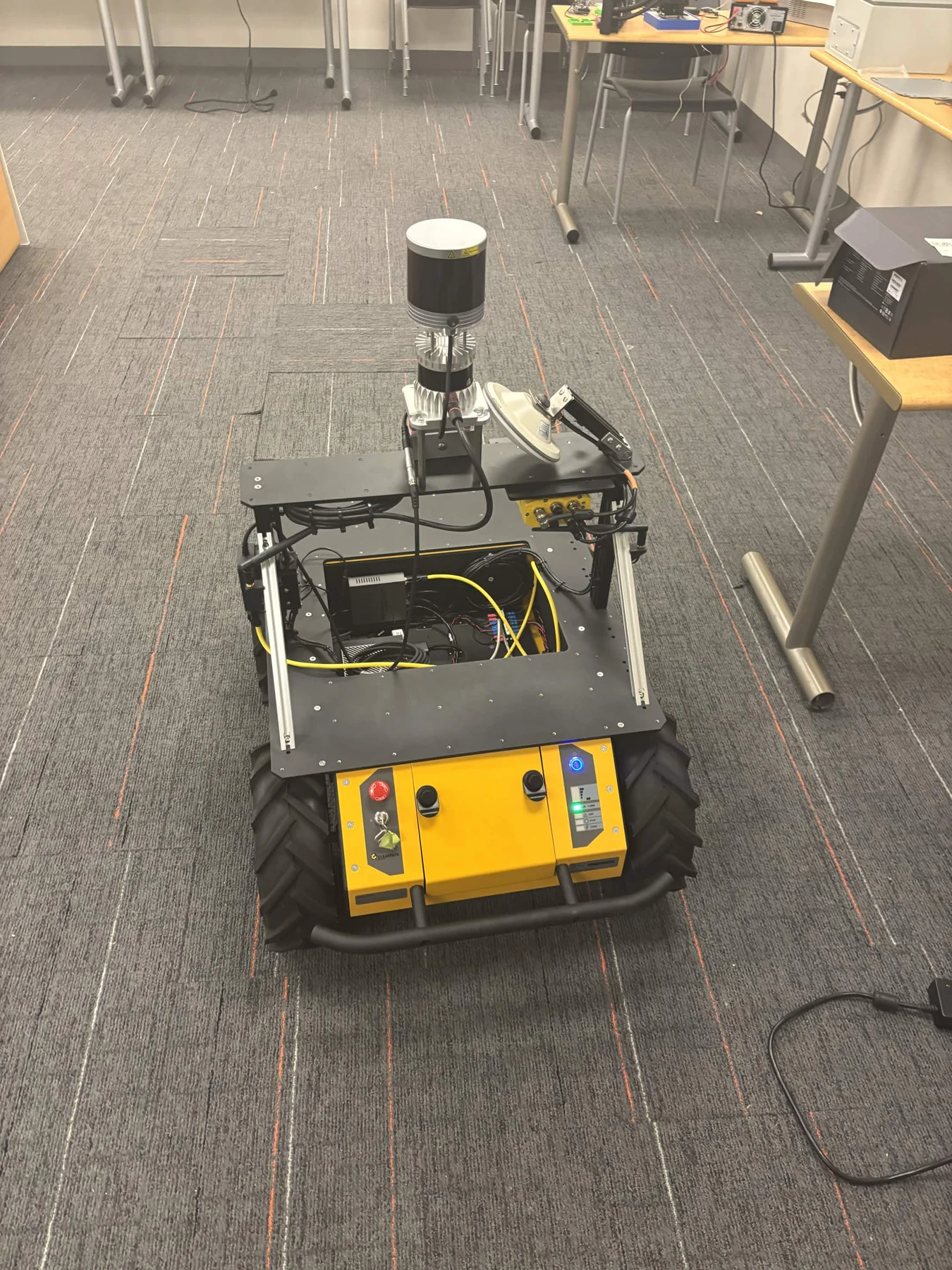
The Husky robot and its first LiDAR installation were already in place. I integrated the second sensor and used existing drivers and libraries alongside the project code. My work centred on the integration, experiments, analysis, and interpretation.
- Integrated the second LiDAR into the existing robot setup.
- Collected static and moving-platform datasets and moving-vehicle observations.
- Examined detection rates, fitted geometry, measurement scatter, and scan-boundary behaviour.
- Prepared the figures, interpreted the findings, and wrote the manuscript.
The experiments
Four ways to
test a point cloud.
- Static spherical targetsMeasure target detection and fitted centre stability across distance, with both robot and targets stationary.
- A static reference planeCompare fitted-plane residuals and geometric consistency against a flat target.
- A moving robot, fixed targetsInvestigate how robot motion, scan boundaries, and odometry-based deskewing affect the same target geometry.
- A moving vehicleObserve a car at nominal speeds of 10, 20, and 30 km/h, including broadside passes and approaches.
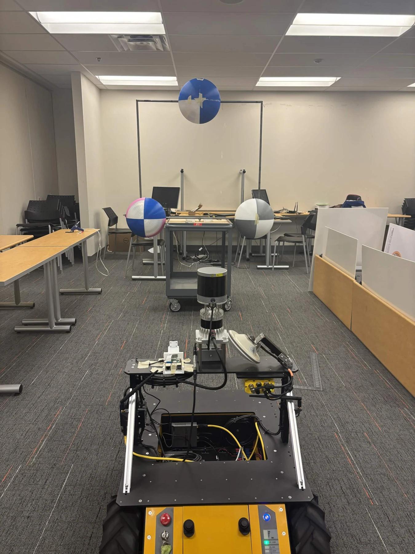
Tools and environment: ROS Noetic, Ubuntu 20.04, Jetson AGX Orin, sensor drivers, existing processing libraries, and project-specific analysis.
Selected findings
The scan boundary
is part of the measurement.
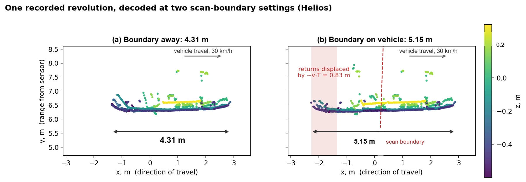
A full rotation has to be divided into individual scans somewhere. If that boundary crosses a moving target, the cloud can combine parts of the target captured at substantially different times.
A different boundary.
0.84 m of apparent length.
Re-decoding the same Helios packet recording at 30 km/h changed the car's measured apparent length when the scan boundary was moved onto the vehicle.
Boundary away from the car
Boundary on the car
Detection changed with the boundary, too.
During one 393-scan approach at 0.85 m/s, moving the Helios scan boundary from forward to behind the robot increased raw three-sphere detection from 5.3% to 13.0%. It also reduced the scatter in the measured target geometry.
That result made configuration a central part of the analysis: changes in scan grouping could affect the observed geometry even without changing the physical sensor.
Static precision needs its own context.
In the static-plane experiments, fitted-plane RMS residuals were comparable, at roughly 5.7–7.2 mm. Different sampling densities and target-detection behaviour mattered alongside those residuals.
These are descriptive results from the tested setups. Adjacent scans are correlated; mount heights, target measurements, accepted detections, and the limited number of vehicle passes constrain the comparison. The study does not establish a universal sensor ranking.
What I learned
Understand the capture.
Then trust the geometry.
This project connected hardware integration, experimental design, point-cloud analysis, and technical writing. The most useful lesson was to treat scan timing and grouping as part of the measurement process, especially when evaluating a moving scene.
It also reinforced the value of controlled comparisons: re-processing the same underlying recording helped isolate a configuration effect that would be harder to separate across different runs.
Study: “Comparative Point-Cloud Characterization of Two 32-Channel Rotary LiDARs for Mobile Robot Perception,” Nicolas Polga and Moein Mehrtash. Figures shown here come from the project materials.